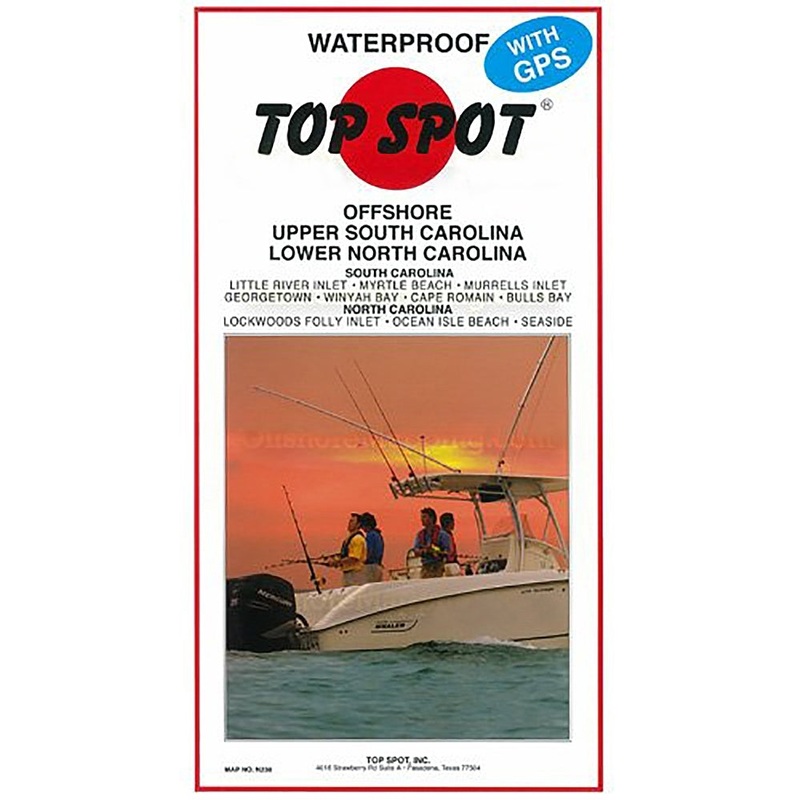
Sale!

Top Spot Fishing Map N238, Carolina Offshore

$15.59 $25.99
Review

Offshore, Upper South Carolina and Lower North Carolina, ( Bulls Bay to Lockwoods Folly Inlet ). Top Spot Fishing Maps are waterproof and include best fishing times, the best habitats and underwater structure. Detailed information and GPS coordinates are p

  • Satisfaction 100% Guaranteed
  • Free shipping on orders over $30
  • 60 day easy Return

Qty:

SKU: OH16992815 Category:

Description

Offshore, Upper South Carolina and Lower North Carolina, ( Bulls Bay to Lockwoods Folly Inlet ). Top Spot Fishing Maps are waterproof and include best fishing times, the best habitats and underwater structure. Detailed information and GPS coordinates are provided for fishing locations, boat ramps, marinas and other points of interest. 2 sides, full color fishing and diving recreation map.

Reviews

There are no reviews yet.

Be the first to review “Top Spot Fishing Map N238, Carolina Offshore”

Your email address will not be published. Required fields are marked *